
Reading an article, one number caught my eye: 600,000 text alerts were sent at 9:15 AM, and the last data from a water level station cut off at 9:20 AM. The gap between the warning and the silence was four minutes. An early warning system existed, but before the flood even arrived, the system itself was swept away by the water.
That four-minute window stuck with me, so I looked deeper into the data. The causes have been somewhat established, but moving into “why couldn’t it be prevented” and “what can be done differently next time” makes the situation much more complex. There is no way to stop a glacier from collapsing. However, could a significant portion of the subsequent damage have been avoided?
August 26: What Exactly Collapsed?
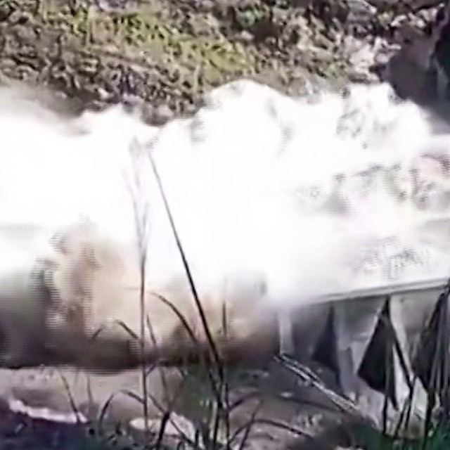
Around 8:37 AM local time on August 26, a massive block of glacier and bedrock collapsed near Langtang Lirung (approx. 7,234m above sea level) on the border between the Rasuwa district of Nepal and Tibet, China. The collapse occurred at an altitude of about 5,200m. Ice and rock poured into the Lende Khola River below, temporarily blocking the narrow valley to form a natural dam. The trapped water soon burst through, releasing a torrent that surged downstream along the Trishuli River, carrying ice, rock, and debris.
To summarize: Glacial/rock collapse → valley blockage → formation of a temporary natural dam → dam collapse → flash flood → amplification by debris flow. This six-stage chain reaction is the sequence of the disaster. ICIMOD experts suggest the narrow section of the Lende Khola likely acted as this temporary dam. The collapse generated seismic waves equivalent to a magnitude 5.2 earthquake, detectable by seismographs worldwide. Water levels at the downstream Galchi point rose by up to 9 meters in 30 minutes, and 7 meters at the Malekhu point in the same timeframe. While initially reported as an earthquake-induced landslide, the U.S. Geological Survey (USGS) confirmed two days later, after analyzing long-period seismic waves, that the vibrations were caused by the collapse of ice and rock, not an earthquake.
A typical GLOF (Glacial Lake Outburst Flood) involves the bursting of an existing glacial lake, but initial analysis concluded that no such lake of that scale existed upstream of the collapse path. In other words, it wasn’t a lake that burst; rather, the mountainside collapsed, creating a new lake and dam on the spot, which then immediately failed. This distinction might seem minor, but it is directly linked to the limitations of the early warning system, which I will discuss later.
The Extent of the Damage
As of August 31, when I am writing this, the Nepal National Disaster Risk Reduction and Management Authority reports at least 788 deaths and 2,502 missing, including 592 foreigners. Adding the 16 deaths and 546 missing (261 foreigners) in China’s Tibet Autonomous Region, the combined total is at least 804 dead and 3,048 missing. Since post-disaster counts fluctuate, these figures are best viewed as a snapshot at the time of writing rather than final tallies.
Infrastructure damage was also severe. Nepali authorities reported that 40km of roads and 80 bridges were destroyed. The Gyirong port, a Nepal-China border checkpoint, was damaged to the point where building outlines were unrecognizable, and many of the missing were Hindu pilgrims. The Nepal Ministry of Tourism stated that at least 133 of the missing were Indians on a pilgrimage to Mount Kailash in Tibet.
Most painful is the damage to hydropower plant sites. Authorities estimate that at least 933 workers are missing across more than 11 plant sites in the hard-hit Bagmati Province. There were reports that over 100 people might be alive but isolated in the tunnels of the Trishuli 3A and 3B plants in Rasuwa. At the 216MW Upper Trishuli-1 (UT-1) plant, being built by Korea South-East Power and Doosan Enerbility, nine Korean workers have been missing for over five days. This accident illustrates that the very terrain that makes for efficient hydropower due to narrow gorges and steep drops is also the terrain most vulnerable to landslides and debris flows.
*## How Far Back Must We Trace the Root Cause?
This is where my real interest lies. While the direct trigger was confirmed as a glacial and rock collapse, the question of “why now, and why this mountain” leads back to a much older history.
First is the physical destabilization of the glaciers themselves. Recent studies indicate that glaciers in the Langtang region have been retreating and breaking off 1.5 times faster between 2000 and 2023 than in previous periods. Rising temperatures don’t just melt glaciers; they thaw the permafrost that binds rock fissures and mountainsides together, compromising the structural stability of the mountains themselves. Experts generally agree that for glaciers hanging on steep slopes like Langtang Lirung, permafrost melting loosens the “ice glue” that holds everything in place. With the Himalayas warming at more than twice the global average, this background process is accelerating.
Second is the structural blind spot of early warning systems. Existing GLOF warning systems typically monitor water levels and volume in known glacial lakes. However, this accident occurred at a location not on the surveillance list—a case where the mountain slope itself collapsed, not an existing glacial lake. The deputy director of the Institute of Tibetan Plateau Research at the Chinese Academy of Sciences noted at a Kathmandu conference that the disaster was partly because “the collapsed glacial lake was not designated as a primary monitoring target.” ICIMOD lists 47 high-risk glacial lakes across the Koshi, Gandaki, and Karnali river basins (25 in Tibet, 21 in Nepal, 1 in India), but this collapse site was not among them.
Third is the physical limitation of the monitoring equipment itself. According to Nepali media outlet Online Khabar, the water level sensors, which should have measured levels every 10 minutes to issue alerts, failed to function properly. The first alert to residents was issued around 9:15–9:16 AM, about 30 minutes after the flood reached the Bhotekoshi River, and over 600,000 text alerts were sent to residents along the rivers in Rasuwa, Nuwakot, Dhading, and Chitwan.
However, just 4–5 minutes later, around 9:20 AM, the Vetrawati station’s sensor was destroyed, cutting off all data. The final reading sent was 3.55m, which was below the 4.1m threshold for issuing a warning. Subsequently, monitoring equipment in Langtang, Rasuwagadhi, Vetrawati, Syabrubesi, and Malekhu were successively swept away. The system was structured in such a way that the sensors meant to trigger the warning were the first things to disappear when the warning was needed most.
Fourth is the gap in cross-border information sharing. The Chinese Embassy in Nepal denied criticism that “China did not provide advance risk information,” stating that meteorological authorities from both countries exchanged data via an emergency video conference on the day of the flood. However, it was not disclosed whether the warning system detected anomalies in advance, or exactly when Chinese authorities grasped the situation and when they notified Nepal. While the Institute of Tibetan Plateau Research claims it has been building a cross-border multi-dimensional disaster warning network using satellite remote sensing and ground monitoring since 2017, this network failed to account for a collapse in an unmonitored location. When a glacial lake burst in Tibet in 2016, affecting the China-Nepal highway and the Bhotekoshi river basin, ICIMOD already pointed out the necessity of real-time data sharing and upstream early warning networks. This is not the first time such warnings have been ignored.
Fifth is the issue of the speed at which risk is priced into development. When building power plants, flood risk is factored in. The problem is the baseline year of those calculations. Risk assessments based on 10 or 20-year-old precipitation patterns are entirely different from the reality where glaciers are visibly melting and permafrost is thawing.
An Energy Economy article pointed this out as the need for “development that prices in risk.” This hits the core of the accident. Climate change is altering the frequency and intensity of risks, but risk models and international funding are failing to keep pace. The fact that the Green Climate Fund (GCF) disaster prevention project for Nepal was selected in 2018 but didn’t receive final approval until July 2025 illustrates this speed gap. The risk was known; the response was just too slow.
So, What Can We Do?
Experts have proposed five main takeaways from this accident. While no single measure can prevent such disasters entirely, layering them might slightly extend the “four minutes between the warning and the silence.”
- Expand monitoring beyond glacial lakes. Current systems track known lakes, but as this accident showed, new natural dams and lakes can form in hours in previously safe areas. Experts suggest tracking glacier movement, permafrost temperatures, and mountain slope cracks via satellite.
- Increase sensor survivability. Disaster expert Dinanath Bhandari suggests a dual-sensor approach: standard sensors near rivers and backup sensors installed 20–30m higher to survive major floods. There are also calls for installing surveillance cameras and vibration sensors in high-risk areas to trigger automatic alerts if abnormal movement is detected.
- Institutionalize real-time cross-border data sharing. Himalayan rivers cross borders. ICIMOD has long argued for a system where countries share monitoring data and flood warnings in real-time, as disasters starting in one country can devastate neighbors.
- Restrict construction in floodplains and secure evacuation routes. Dr. Alton Byers of the University of Colorado Boulder suggests avoiding construction in floodplains and developing clearly marked evacuation routes. We shouldn’t rely solely on technology; we must prevent construction in high-risk areas and ensure people have a way to escape.
- Accelerate update cycles for risk models and international funding. Updating risk models with the latest climate data and shortening the approval process for international climate funds like the GCF are essential. We also need post-evaluation systems for infrastructure projects to assess how well flood and landslide risks were incorporated.
However, experts agree that even with all five in place, “there is no magic technology to perfectly predict the next collapse.” Dr. Byers noted that these floods are “no longer a question of if, but when.” This means we need practical disaster prevention measures that turn short warning times into actual survival time for residents.
Is This the Future of the Himalayas?
Looking at the broader picture, this isn’t just a problem for one valley. The glacier area in the Hindu Kush-Himalayan region shrank by about 12% between 1990 and 2020, with the rate of decline accelerating since 2010. The central Himalayas, including Nepal, saw a 20.7% reduction, a steeper decline than other regions. There are over 25,000 identified glacial lakes across the Himalayas.
For years, the scientific community has warned that about 15 million people worldwide are in the potential impact zone of a GLOF, with China and Pakistan often ranked higher in composite risk indices than Nepal. Yet, Nepal suffered the massive casualty event. This shows that risk indices are just probabilities; where a disaster strikes first is an entirely different matter.
More concerning is that this is not the end. Himalayan glaciers act as massive natural reservoirs, the water source for 12 major Asian rivers, including the Indus, Ganges, and Brahmaputra. They store snow as ice in winter and release it slowly in the dry season. Currently, the problem is too much melting, but once they are gone, the opposite problem—drought—will arise. Some projections suggest up to 40% of glaciers could disappear by the end of the century. With over 240 million people relying on this region, the current floods and future droughts are two sides of the same coin.
Personally, I hesitated at this point. When news mentions a “flood warning,” we usually imagine having a few hours of lead time. But with this type of disaster, the time from onset to the village being hit is barely 30 minutes. The stages of “detection, judgment, and communication” are effectively racing against the disaster, and I’ve learned that in this race, the monitoring equipment is the first casualty. Having a plan doesn’t mean the next accident won’t happen. However, the speed at which those countermeasures reach the field must, at the very least, be faster than the speed at which the glaciers are melting.
References
- https://en.wikipedia.org/wiki/2026_Nepal_floods
- https://www.aljazeera.com/features/2026/8/27/nepal-tibet-floods-what-is-a-glacial-collapse-how-common-is-it
- https://www.antarcticglaciers.org/2026/08/august-2026-nepal-tibet-floods/
- https://www.hankookilbo.com/news/article/A2026083009100002514
- https://v.daum.net/v/20260829200528846
- https://www.hankookilbo.com/news/article/A2026082814590002201
- https://www.thepublic.kr/news/articleView.html?idxno=316769
- https://www.newsspace.kr/news/article.html?no=15415
- https://www.newsis.com/view/NISX20260828_0003766650
- https://www.pennmike.com/news/articleView.html?idxno=126719
- https://www.hankyung.com/article/2026082777091
- https://www.fnnews.com/news/202608301607562652
- https://www.ngonews.kr/news/articleView.html?idxno=236697
- https://edata.ekn.kr/article/view/ekn202608290001
- https://en.wikipedia.org/wiki/2024_Thame_flood